Line up your site in seconds with Alignment Paths
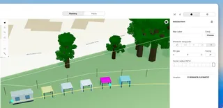
New on the Planning Map: draw an alignment path, then space vendors and plots evenly along it with a minimum gap — ideal for food streets, stall rows, and market lanes.
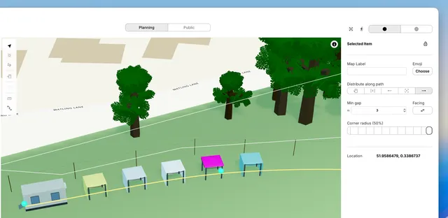
Building a clean food street or stall row used to mean nudging every plot by hand. Now you can draw a guide path and let Eventplot do the lining up for you.
Alignment Paths are a new Planning Map tool for festivals, fairs, and outdoor events. Draw the line of your street or aisle, then distribute vendors, plots, and other layout objects along it — evenly spaced, or packed from the start, centre, or end with a minimum gap you control.
Objects face along the path automatically. Flip facing if you need stalls looking the other way. Vendors on plots move with their plot, so linked layouts stay together. Edit the path later and everything reflows with it.
It’s a planning guide only — great for layout, not shown on the Public Map.
Whether you’re sketching a new market lane or tightening gaps on an existing row, Alignment Paths make tidy site plans faster to build and easier to change.
Coming very soon